I drove to Tostock and parked in the Village Hall car park on Norton Road. My ride is all covered by the Ordnance Survey Map 211 - Bury St Edmunds and Stowmarket. Here is an online map for part 1 of the ride.
I turned left out of the carpark and left onto Church Rd through the village past the inviting Gardeners Arms. I turned right onto the A1088 and immediately right again crossing the A14, then left into Woolpit.
 This is the view up The Street from the village pump in the centre of the village. Once infamous for its whiff from a nearby rendering plant, (there was no smell when I was there), it is a pretty village with an impressive church.
Continuing onto Green Rd I turned left along Mill Lane then right onto Heath Rd towards Woolpit Heath. Here I turned right towards Drinkstone, then left just after a right-hand bend, past the Drinkstone Mills into Drinkstone. Following the road round to the left, opposite the church I found another for my collection of almshouses.
 I continued along Gedding Rd into Drinkstone Green (and onto this online map). Here I turned left towards Rattlesden passing some rather good-looking houses and downhill towards the Rattlesden River. Turning left at the T-junction, I followed the road into Rattlesden- another gorgeous village, full of character. I did a circuit up the High St past the church and back down Lower Rd to the Old Moot Hall below the church.
 Just round the bend there, I turned left onto Birds Green and up the hill (pausing to look back at the lovely cottages at the bottom) and on towards Buxhall (and onto online map part 3). Here, by the Crown Inn I passed another of Suffolk's windmills. At the T-junction I turned left and then left again at the next T-junction, taking me back towards Woolpit.
At Borley Green (onto map part 4), I turned right, crossing the A14 towards Elmswell, turning left then right onto Warren lane. Elmswell is a growing place - according to its website it has grown from 196 dwellings in 1881 to 1344 now and there seemed to be plenty of building activity. I went stright up Warren Lane, across the road to Wetherden and up past the station towards Great Ashfield (and map part 5). This bit was along a straight flat road, as was the next bit when I turned next left towards Norton at the next junction.
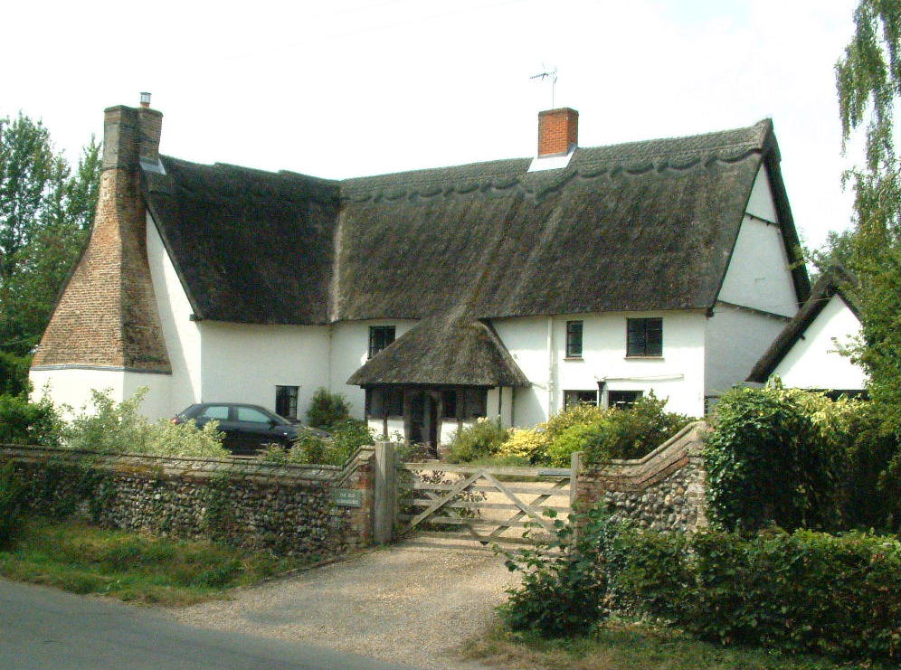
At Norton Little Green, I was rewarded with the sight of Manor Farm...
 ...just as the postman was delivering in his van.
On my last stretch now (and map part 6), I continued to Norton, where I went straight across the A 1088, round the sudden sharp bend at Red Herring cottage and back towards Tostock and the Village Hall.
About 21 miles, it took me about 1 3/4 hours (including breaks) - a good morning's ride. And I managed to get the bike back on the car roof and home again without mishap too.


No comments:
Post a Comment