I got there in just over 1/2 hour, driving up the A143 from Bury St Edmunds to just past Diss, turing right onto the A140 and then taking the first road on the left.
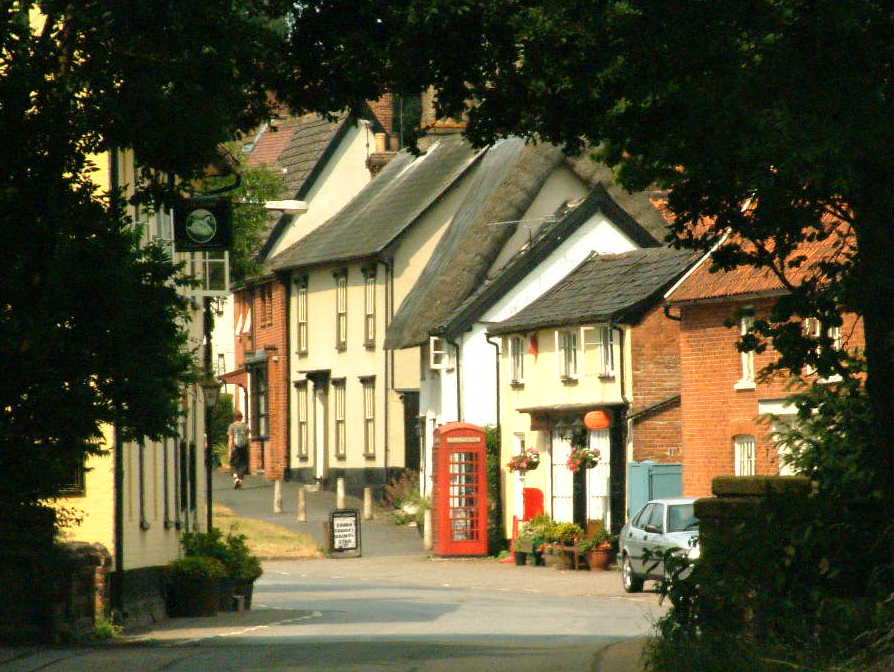 Hoxne, where the walk starts and finishes, has a strong connection with Bury St Edmunds, being the place where King Edmund the martyr was captured and killed by the Danes in AD870. Here is the commemorative stone in the wall of the rather splendid Village Hall.
 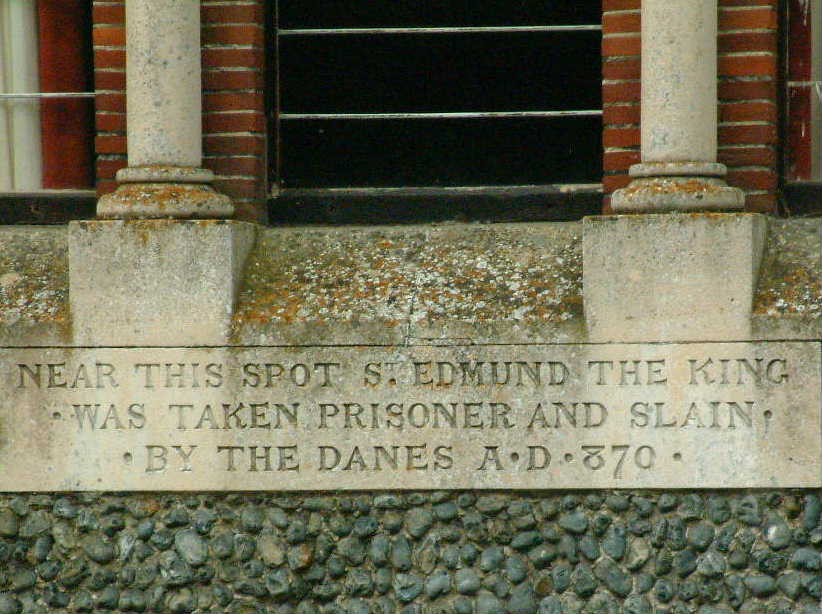 The hall is close to Goldbrook bridge. As *this* website explains...
...legend has it that on this spot King Edmund was captured by the Danes in AD 870 after being given away by a wedding party while hiding under the bridge, to this day it is said that no bride shall cross the bridge on her way to church for fear of bringing bad luck.
Hoxne is also famous for another reason - The Hoxne Treasure, discovered in 1992. Now on display in the British Museum, a vast horde of nearly 15,000 Roman coins was found in a field with a metal detector by Eric Lawes, a retired professional gardener.
Anyway, after the diversion to the village hall, I began the walk in the book. The church was open and I was able to see the medieval wall hangings and a couple of displays - the story of St Edmund and the 1841 census. Then on to the River Waveney.
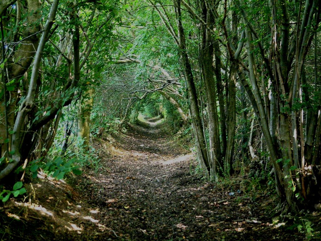
The walk diverges from the newer waymarked circular walk shortly after the footbridge over a weir over the river. It takes you along this rather spooky green lane...
 on the way towards Thorpe Abbots. It was here I became unstuck and wished I wasn't wearing shorts. The guide says to take a path from the Car Park at Highfield Fishery. Hmm. It was about 1 ft wide, with barbed wire on one side and thick brambles in the hedge on the other. And I had bare legs. Ouch.
 I gave up after a few yards. Instead I backtacked and went down School Lane and then onto the footpath at the end which ends up at the drive to Wood Cottage. Apart from the next bit, which was rather overgrown going round a field going towards Grove Farm, the rest of the walk was OK, although I did get stung by a few nettles.
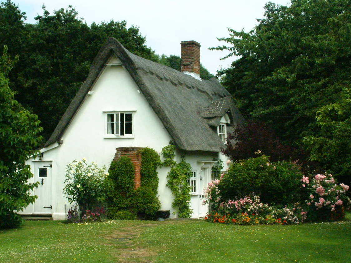
There are some lovely houses and gardens at Upper Street. Here is Unicorn Cottage...
 Thence on to Billingford with its Tower Mill...
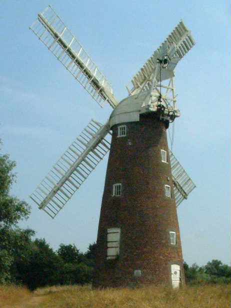 and back to Hoxne via Oakley Park. A good long walk with some nice scenery. But I must wear long trousers next time!
Postscript : It is only fair to point out that Hoxne's claim to being the place of Edmund's death is disputed. Both the History section of the St Edmundsbury Council website and the Canon of Lydgate project suggest that a field near Bradfield St. Clare is more likely.


3 comments:
Do look at the main theory for where Edmund was martyred before deciding to go with the Hoxne one. It was believed for years that Hoxne was the place but there is compelling evidence to suggest it was actually much closer to home in a field called "Hellesdon" near Bradfield St Clare. And there's also evidence to suggest that the Hoxne claim came about for political reasons.
(I meant to say "other" main theory in that first line.)
Hi Ruby - quite right. I just spotted your comments as I was adding a postscript explaining that Hoxne's claim is disputed!
Post a Comment